
Historic US Route 6 is the longest highway ever created in the United States of America. It stretches 3,652 miles from Provincetown, Massachusetts, to Long Beach California. The historic beginning of Route 6 is the traffic circle at Pilgrims Park, which is where the pilgrims first landed on American soil. In addition, Iowa Historic Route 6 communities have history connected with Jesse James, Bonnie & Clyde, John Wayne, the original Nancy Drew Mystery Series author, Jack Kerouac, and more. With books, TV series, and documentaries either published or in progress, there is a nationwide awakening to the significance of this historic highway. Pennsylvania has an active Route 6 Tourist Assn which generates 90 plus million dollars of revenue statewide per year. 3 Travelers on Interstate 80 on average spend only 5 hours in Iowa, seeing only corn and overpasses. Most of the commerce is with chain restaurants. By the time they are through, there is little incentive to stay or revisit. By contrast, Historic Route 6 offers a relaxing scenic drive through winding hills and charming historic communities. Travelers across Historic 6 potentially will have between 1 and 3 overnight stays. Overnight travelers spend three times as much as those just passing through. In addition, they will likely return to see what they’ve missed. However, between 1956 and 1980, over one third of the original Iowa alignment was straightened, or realigned on to Interstate 80, bypassing over 16 of the its original 40 plus communities, including Walcott, Durant, Wilton, Victor, Carnforth, Brooklyn, Lambs Grove, Colfax, Mitchellville, Redfield, Dexter, Stuart, Menlo, Casey, Adair, Anita, and Wiota. Communities without traffic lose commerce, and begin a decline. City maps below are courtesy of Jason Hancock and Jeff Morrison from their respective web sites.
Click here to see the US Route 6 Google Map
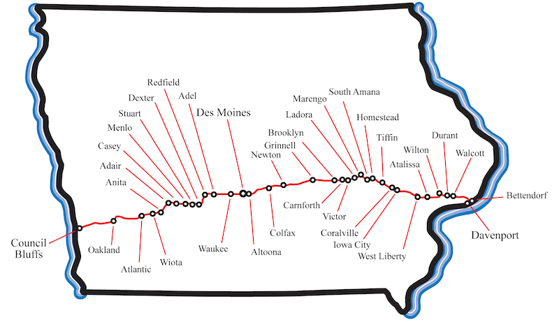
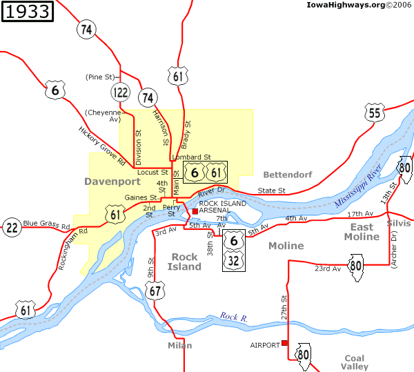
The Historic Route is as follows: The Iowa Route 6 Tourist Association formally requested and and was granted permission from the Iowa Department of Transportation for the original US Route 6 alignment as listed below to be named and listed as a Historic/Heritage Highway, Byway or Trail. The original city route in Davenport as feasible, (see map below) from the Government Bridge to the junction with current US 6 at Hickory Grove Road, continuing on current US 6 until the junction with I-280. From thence, continuing on County Road F58 to the junction of current US 6 at IA 38/US 6, west of Wilton.
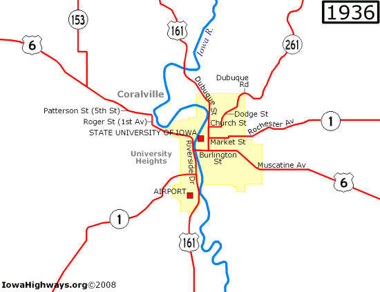
Historic 6 will run concurrent with current US 6 to a point past West Liberty, until the junction with American Legion Road/CR F46. (Pre 1958 US 6 alignment.) This continues on the original Iowa City US 6 alignment, Muscatine Ave, then west on Burlington Street, to junction with current US 6 at Riverside Drive. (See map.) This brings travelers into the heart of Iowa City. Historic Route 6 will continue concurrent with US 6 turning north at 1st Avenue in Coralville, then westerly across 5th street, until rejoining again with current US 6.
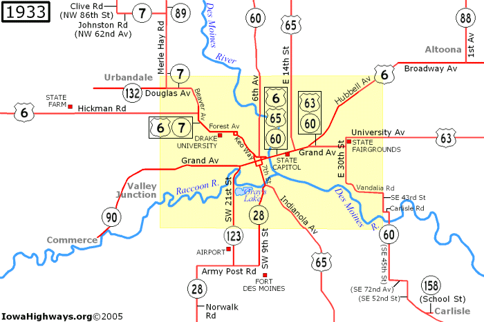
Historic Route 6 continues with current 6 past Tiffin, and then Upper and Lower Old 6 Roads shall be marked. From this point Historic and current 6 will again run together until D Avenue (County Road F29, a pre-1956 alignment of US 6) then rejoining current 6 at North US 63, and continuing to the west end of Newton. Historic 6 will continue straight west from Newton along County Road F48 until it reaches Altoona, and rejoins current 6 at Hubbell Avenue in Des Moines. At Des Moines, Historic 6 should at some point follow the original city alignment that served the Iowa State Capital building, rejoining current US 6 at Hickman Road. (See map) Note: there has been some talk of eliminating the one ways in Des Moines that affect the feasibility of these alignments.
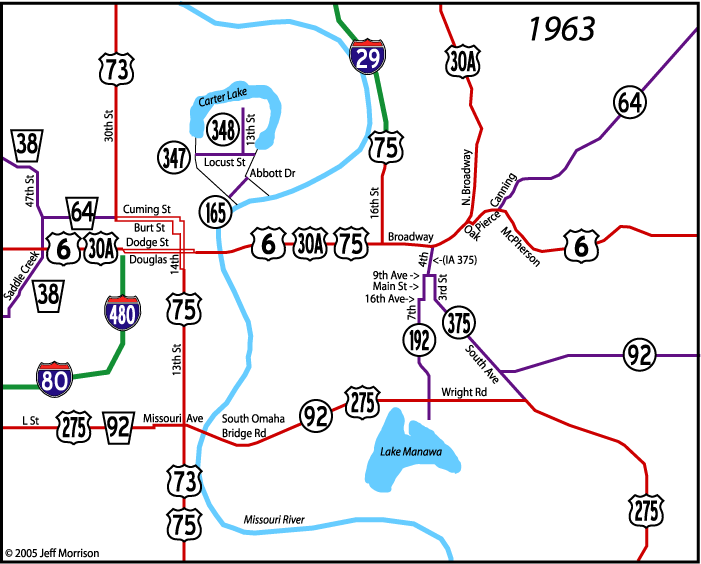
Historic 6 will again run concurrent with US 6 to Adel, then continuing straight on County Road F59 through Adel and Redfield. This curves south, and turns west at County Road F65, following what is known as the White Pole Road to Adair, before turning onto County Road G30. This will continue to Anita, where the road becomes Iowa State Highway 83, before rejoining current US 6 in Atlantic. Historic 6 will diverge once more east of Council Bluffs at County Road G60 (McPherson Ave) as much as feasible (the original alignment is cut in half by the Council Bluffs Airport.) and will follow as closely as possible the original city alignment of Broadway Avenue. (See map). This will bring Travelers in on the Historic McPherson Ave alignment with the scenic Loess Hills, and into the recently revitalized Historic Broadway Avenue District.</p>
All city maps courtesy of iowahighways.org except for the Council Bluffs map, which is from iowahighwayends.net
State map copyright Iowa US Route 6 Tourist Association.